Template:Pp-move-indef Template:US state
| The Flag of New Mexico. | |
| The Seal of New Mexico. | |
| Animate insignia | |
| Bird(s) | Greater Roadrunner |
| Fish | Rio Grande cutthroat trout |
| Flower(s) | Yucca |
| Grass | Blue grama |
| Mammal(s) | American Black Bear |
| Reptile | New Mexico whiptail |
| Tree | Colorado Pinyon |
| Inanimate insignia | |
| Colors | Red & Yellow |
| Fossil | Coelophysis |
| Gemstone | Turquoise |
| Song(s) | "O' Fair New Mexico" |
| Route marker(s) | |
| State Quarter | |
| Released in 2008 | |
| Lists of United States state insignia | |
New Mexico( /en-us-New Mexico.oggnjuː ˈmɛksɪkoʊ/) is a state located in the southwest and western regions of the United States. New Mexico is also part of the Mountain States. With a population density of 16 per square mile, New Mexico is the sixth-most sparsely inhabited U.S. state.
Inhabited by Native American populations for many centuries, it has also been part of the Imperial Spanish viceroyalty of New Spain, part of Mexico, and a U.S. territory. Among U.S. states, New Mexico has the highest percentage of Hispanics, including descendants of Spanish colonists and recent immigrants from Latin America. It also has the third-highest percentage of Native Americans, after Alaska and Oklahoma, and the fifth-highest total number of Native Americans after California, Oklahoma, Arizona, and Texas.[1] The tribes in the state consist of mostly Navajo and Pueblo peoples. As a result, the demographics and culture of the state are unique for their strong Hispanic and Native American influences. The flag of New Mexico is represented by the red and gold colors, which represent Spain as well as the Zia symbol, an ancient Native American symbol for the sun.[2]
Geography[]
The state's total area is 121,412 square miles (314,456 km2).[3] The eastern border of New Mexico lies along 103° W longitude with the state of Oklahoma, and three miles (5 km) west of 103° W longitude with Texas.[3] On the southern border, Texas makes up the eastern two-thirds, while the Mexican states of Chihuahua and Sonora make up the western third, with Chihuahua making up about 90% of that. The western border with Arizona runs along the 109° 03' W longitude.[3] The southwestern corner of the state is known as the Bootheel. The 37° N latitude parallel forms the northern boundary with Colorado. The states New Mexico, Colorado, Arizona, and Utah come together at the Four Corners in the northwestern corner of New Mexico. New Mexico, although a large state, has little water. Its surface water area is about 250 square miles (647 km2).
The New Mexican landscape ranges from wide, rose-colored deserts to broken mesas to high, snow-capped peaks. Despite New Mexico's arid image, heavily forested mountain wildernesses cover a significant portion of the state, especially towards the north. The Sangre de Cristo Mountains, the southernmost part of the Rocky Mountains, run roughly north-south along the east side of the Rio Grande in the rugged, pastoral north. The most important of New Mexico's rivers are the Rio Grande, Pecos, Canadian, San Juan, and Gila. The Rio Grande is the eighth longest river in the U.S.
Template:Stack begin
Wheeler Peak
Sangre de Cristo Range
Aztec Ruins National Monument
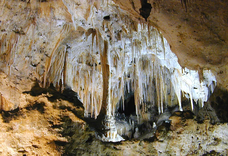
Carlsbad Caverns
Rio Grande Gorge
White Sands National Monument
Template:Stack end
The U.S. government protects millions of acres of New Mexico as national forests including:[4]
- Carson National Forest
- Cibola National Forest (headquartered in Albuquerque)
- Lincoln National Forest
- Santa Fe National Forest (headquartered in Santa Fe)
- Gila National Forest
- Gila Wilderness
Areas managed by the National Park Service include:[5]
- Aztec Ruins National Monument at Aztec
- Bandelier National Monument in Los Alamos
- Capulin Volcano National Monument near Capulin
- Carlsbad Caverns National Park near Carlsbad
- Chaco Culture National Historical Park at Nageezi
- El Camino Real de Tierra Adentro National Historic Trail
- El Malpais National Monument in Grants
- El Morro National Monument in Ramah
- Fort Union National Monument at Watrous
- Gila Cliff Dwellings National Monument near Silver City
- Old Spanish National Historic Trail
- Pecos National Historical Park in Pecos
- Petroglyph National Monument near Albuquerque
- Salinas Pueblo Missions National Monument at Mountainair
- Santa Fe National Historic Trail
- White Sands National Monument near Alamogordo
Visitors also frequent the surviving native pueblos of New Mexico. Tourists visiting these sites bring significant money to the state. Other areas of geographical and scenic interest include Kasha-Katuwe Tent Rocks National Monument and the Valles Caldera National Preserve. The Gila Wilderness lies in the southwest of the state.
Climate[]
The climate of New Mexico is generally semi-arid to arid, though there are areas of continental and alpine climates, and its territory is mostly covered by mountains, high plains, and desert. The Great Plains (High Plains) are located in the eastern portion of the state, similar to the Colorado high plains in eastern Colorado. The two states share plenty similarities in terrain, with both having plains, mountains, basins, mesas, and desert lands. New Mexico's average precipitation rate is 13.9 inches ({{rnd/bExpression error: Unexpected < operator.|Expression error: Unexpected < operator.|(Expression error: Unexpected < operator.)|Expression error: Unexpected < operator. }} mm) a year. The average annual temperatures can range from Template:Convert/°F in the southeast to less than Template:Convert/°F in the northern mountains.[3] During the summer months, daytime temperatures can often exceed Template:Convert/°F at elevations below 5,000 feet ({{rnd/bExpression error: Unexpected < operator.|Expression error: Unexpected < operator.|(Expression error: Unexpected < operator.)|Expression error: Unexpected < operator. }} m), the average high temperature in July ranges from Template:Convert/°F at the lower elevations to the upper 70s (°F, up to 26 °C) at the higher elevations. Many cities in New Mexico can have temperature lows in the 20's and into the teens as well. The highest temperature recorded in New Mexico was Template:Convert/°F at the Waste Isolation Pilot Plant near Loving on June 27, 1994 and the lowest recorded temperature is Template:Convert/°F at Gavilan on February 1, 1951. [6] New Mexico also receives a decent amount of snow as well, and a lot of snow in its higher elevations in the mountains.
Flora and fauna[]
New Mexico offers habitat for occurrence of many plant and animal species, with emphasis upon many desert areas and large amounts of pinon-juniper woodland. Creosote bush, mesquite, cacti, yucca, and desert grasses, including black grama, purple three-awn, tobosa, and burrograss, cover the broad, semiarid plains that cover the southern portion of the state. The northern portion of the state is home to many tree species such as ponderosa pine, aspen, cottonwood, spruce, fir, and Russian olive, which is an invasive species. Native birds include the Road-runner, Geococcyx californianus[7] and Wild turkey, Meleagris gallopavo subspecies mexicana.[8] Other fauna present in New Mexico include black bears, cougars, coyotes, porcupines, skunks, Mexican gray wolves, deer, elk, bison, javalina, big horn sheep, squirrels, chipmunks, pronghorn, western diamondback, kangaroo rat, jackrabbit and a multitude of other birds, reptiles, and rodents.
History[]
Desert scene near Chaco Canyon
The Organ Mountains Near Las Cruces
Los Alamos National Laboratory and the town of Los Alamos, New Mexico
- Main article: History of New Mexico
The first known inhabitants of New Mexico were members of the Clovis culture of Paleo-Indians.[9]Template:Rp Later inhabitants include Native Americans of the Mogollon and the Anasazi cultures.[10]Template:Rp By the time of European contact in the 16th century, the region was settled by the villages of the Pueblo peoples and groups of Navajo, Apache and Ute.[9]Template:Rp
Francisco Vázquez de Coronado assembled an enormous expedition at Compostela in 1540–1542 to explore and find the mystical Seven Golden Cities of Cibola as described by Fray Marcos de Niza.[10]Template:Rp The name Nuevo México was first used by a seeker of gold mines named Francisco de Ibarra who explored far to the north of Mexico in 1563 and reported his findings as being in "a New Mexico".[11] Juan de Oñate officially established the name when he was appointed the first governor of the new Province of New Mexico in 1598.[10]Template:Rp In 1598 he founded the San Juan de los Caballeros colony, the first permanent European settlement in the future state of New Mexico,[12] on the Rio Grande near Ohkay Owingeh Pueblo.[10]Template:Rp Oñate extended El Camino Real de Tierra Adentro, "Royal Road of the Interior," by 700 miles (1,100 km) from Santa Bárbara, Chihuahua to his remote colony.[13]Template:Rp
The settlement of Santa Fe was established at the foot of the Sangre de Cristo Mountains, the southernmost subrange of the Rocky Mountains, around 1608.[13]Template:Rp The city, along with most of the settled areas of the state, was abandoned by the Spanish for 12 years (1680–1692) as a result of the successful Pueblo Revolt.[14] After the death of the Pueblo leader Popé, Diego de Vargas restored the area to Spanish rule.[10]Template:Rp While developing Santa Fe as a trade center, the returning settlers founded Albuquerque in 1706 from existing surrounding communities,[10]Template:Rp naming it for the viceroy of New Spain, Francisco Fernández de la Cueva, 10th Duke of Alburquerque.[15]
As a part of New Spain, the claims for the province of New Mexico passed to independent Mexico in 1821 following the Mexican War of Independence.[10]Template:Rp The Republic of Texas claimed the portion east of the Rio Grande when it seceded from Mexico in 1836.[16] Texas was separated from New Mexico by the Comancheria and its only attempt to establish a presence or control in the claimed territory was the failed Texas Santa Fe Expedition. The extreme northeastern part of New Mexico was originally ruled by France, and sold to the United States as part of the Louisiana Purchase in 1803.[17] The Spanish population increased rapidly, possibly to 25,000 by 1800. The Apache and Comanche raids on Hispanic settlers were common until well into the period of U.S. occupation.[18]
Following the Mexican-American War, from 1846–1848 and the Treaty of Guadalupe Hidalgo in 1848, Mexico ceded its mostly unsettled northern holdings, today known as the American Southwest and California, to the United States of America.[10]Template:Rp In the Compromise of 1850 Texas ceded its claims to the area lying east of the Rio Grande in exchange for ten million dollars.[10]Template:Rp The United States acquired the southwestern boot heel of the state and southern Arizona below the Gila river in the mostly desert Gadsden Purchase of 1853.[10]Template:Rp
Congress admitted New Mexico as the 47th state in the Union on January 6, 1912.[10]Template:Rp
Template:USCensusPop
During World War II, the first atomic bombs were designed and manufactured at Los Alamos and the first was tested at Trinity site in the desert on the White Sands Proving Grounds between Socorro and Alamogordo.[10]Template:Rp
New Mexico has benefited from federal government spending. It is home to three Air Force bases, White Sands Missile Range, and the federal research laboratories Los Alamos National Laboratory and Sandia National Laboratories. The state's population grew rapidly after World War II, going from 531,818 in 1940 to 1,819,046 in 2000.[19][20] Employment growth areas in New Mexico include microelectronics, call centers, and Indian casinos.[21]
Demographics[]
New Mexico Population Density Map.
Population[]
As of July 1, 2008, the United States Census Bureau estimated New Mexico's population at 1,984,356,[19] which represents an increase of 165,315, or 9.1%, since the last census in 2000.[22] This includes a natural increase since the last census of 114,583 people (that is 235,551 births minus 120,968 deaths) and an increase due to net migration of 59,499 people into the state.[22] Immigration from outside the United States resulted in a net increase of 34,375 people, and migration within the country produced a net gain of 25,124 people.[22]
The center of population of New Mexico is located in Torrance County, in the town of Manzano.[23]
7.5% of New Mexico's population was reported as under 5 years of age, 25.3% under 18, and 13.1% were 65 or older.[24] Females make up approximately 50.7% of the population.[24]
As of 2000, 8.2% of the residents of the state were foreign-born.[24]
Among U.S. states, New Mexico has the highest percentage of Hispanics, at 46 percent (2010 estimate), including descendants of Spanish colonists and recent immigrants from Latin America.
Important cities and counties[]
Albuquerque
Las Cruces
Santa Fe
Roswell
| Rank | City | County | Population |
|---|---|---|---|
| 1 | Albuquerque | Bernalillo | 545,852 |
| 2 | Las Cruces | Doña Ana | 97,618 |
| 3 | Rio Rancho | Sandoval | 87,521 |
| 4 | Santa Fe | Santa Fe | 75,764 |
| 5 | Roswell | Chaves | 48,366 |
| 6 | Farmington | San Juan | 45,877 |
| 7 | Clovis | Curry | 37,775 |
| 8 | Hobbs | Lea | 34,112 |
| 9 | Alamogordo | Otero | 30,403 |
| 10 | Carlsbad | Eddy | 26,138 |
| Rank | County | Population within county limits |
Land Area sq. miles |
Largest city |
|---|---|---|---|---|
| 1 | Bernalillo | 662,564 | 1,166 | Albuquerque |
| 2 | Doña Ana | 209,233 | 3,807 | Las Cruces |
| 3 | Santa Fe | 147,532 | 1,909 | Santa Fe |
| 4 | Sandoval | 131,561 | 3,710 | Rio Rancho |
| 5 | San Juan | 130,004 | 5,514 | Farmington |
| 6 | Valencia | 76,569 | 1,068 | Los Lunas |
| 7 | McKinley | 71,492 | 5,449 | Gallup |
| 8 | Chaves | 63,060 | 6,071 | Roswell |
| 9 | Otero | 62,776 | 6,627 | Alamogordo |
| 10 | Lea | 59,155 | 4,393 | Hobbs |
Race and ancestry[]
| Race/Ethnicity in New Mexico (2010)[27] | |
|---|---|
| White (alone) | 53.7% |
| Black/African American | 2.1% |
| Asian | 1.4% |
| American Indian | 9.4% |
| Pacific Islander | 0.1% |
| Other | 15.0% |
| Two or more races | 3.7% |
| Hispanic/Latino (of any race) | 46.3% |
According to the Census Bureau, 1.5% of the population is Multiracial/Mixed-Race, a population larger than both the Asian and NHPI population groups.[24] In 2008 New Mexico had the highest percentage (45%) of Hispanics (of any race) of any state,[28] with 83% of these native-born and 17% foreign-born.[29] The majority of Hispanics in New Mexico claim a Spanish ancestry, especially in the northern part of the state. These people are the descendants of Spanish colonists who arrived during the 16th, 17th, and 18th centuries. The state also has a large Native American population, second in percentage behind that of Alaska.[24][30]
According to estimates from the United States Census Bureau's 2006-2008 American Community Survey 3-Year Estimate,[31] New Mexico's population was 1,962,226. The number of New Mexicans of different single races were: White, 1,375,334 (70.1%); Black, 43,931 (2.2%); American Indian or Alaskan Native, 182,136 (9.3%); Asian, 26,767 (1.4%), Native Hawaiian or Pacific Islander, 854 (0.1%), and 273,778 (14.0%) of some other race. There were 59,415 (3.0%) of two or more races. There were 873,171 (44.5%) Hispanics or Latino (of any race).
According to the 2000 United States Census,[32]Template:Rp the most commonly claimed ancestry groups in New Mexico were: Spaniards (18.7%), Mexican (16.3%), American Indian (10.3%), and German (9.8%)
Languages[]
Acoma Pueblo known as "Sky City"
| Languages Spoken in New Mexico | |
|---|---|
| English | (de facto) |
| Spanish | 28% |
| Navajo | 4% |
According the 2000 U.S. Census, 28.76% of the population aged 5 and older speak Spanish at home, while 4.07% speak Navajo.[33] Speakers of New Mexican Spanish dialect are mainly descendants of Spanish colonists who arrived in New Mexico in the 16th, 17th and 18th centuries.[34]
New Mexico is commonly thought to have Spanish as an official language alongside English, due to the widespread usage of Spanish in the state. Although the original state constitution of 1912 provided for a temporarily bilingual government, New Mexico has no official language.
The constitution provided that, for the following twenty years, all laws passed by the legislature be published in both Spanish and English, and thereafter as the legislature should provide.
Prior to 1967, notices of statewide and county elections were required to be printed in English and "may be printed in Spanish." Additionally, many legal notices today are required to be published in both English and Spanish.[35]
In 1995, New Mexico adopted a State Bilingual Song, New Mexico - Mi Lindo Nuevo México.[36]Template:Rp
Religion[]
San Miguel Chapel in Santa Fe is the oldest standing church structure in the United States. Constructed around 1610.
| Religions in New Mexico | |
|---|---|
| Roman Catholic | 26% |
| Protestant | 42% |
| Mainline | 15% |
| Evangelical | 25% |
| Other Protestant | 2% |
| LDS (Mormon) | 3% |
| Jewish | 2% |
| Buddhist | 2% |
| Other Religion | 3% |
| Unaffiliated | 22% |
According to a report compiled by the Association of Statisticians of American Religious Bodies, the largest denominations in 2000 were the Catholic Church with 670,511; the Southern Baptist Convention with 132,675; the Church of Jesus Christ of Latter-day Saints with 42,261 (66,178 year-end 2009);[37] and the United Methodist Church with 41,597 adherents.[38] According to a 2008 survey by the Pew Research Center, the most common self-reported religious affiliation of New Mexico residents are:[39]Template:Rp
Catholic Church hierarchy[]
Within the hierarchy of the Catholic Church, New Mexico belongs to the Ecclesiastical Province of Santa Fe. New Mexico has three dioceses, one of which is an archdiocese:[40]
- Archdiocese of Santa Fe
- Diocese of Gallup
- Diocese of Las Cruces
Economy[]
- Main article: Economy of New Mexico
New Mexico State Quarter circulated in late 2008.
Oil and gas production, tourism, and federal government spending are important drivers of the state economy. State government has an elaborate system of tax credits and technical assistance to promote job growth and business investment, especially in new technologies.
Economic indicators[]
In 2007 New Mexico's Gross Domestic Product was $76.178 billion (preliminary figure).[41] In 2007 the per capita personal income was $31,474 (rank 43rd in the nation).[42] In 2005 the percentage of persons below the poverty level was 18.4%.[43] The New Mexico Tourism Department estimates that in Fiscal Year 2006 the travel industry in New Mexico generated expenditures of $6.5 billion.[44]
As of November 2010, the state's unemployment rate is 8.5%.[45]
Oil and gas production[]
An oil pump or known as a "pumpjack" at New Mexico Tech
The F-22 Raptor is flown by the 49th Fighter Wing at Holloman AFB.
New Mexico is the third leading crude oil and natural gas producer in the United States. The Permian Basin (part of the Mid-Continent Oil Field) and San Juan Basin lie partly in New Mexico. In 2006 New Mexico accounted for 3.4% of the crude oil, 8.5% of the dry natural gas, and 10.2% of the natural gas liquids produced in the United States.[46] In 2000 the value of oil and gas produced was $8.2 billion.[47]
Federal government[]
Federal government spending is a major driver of the New Mexico economy. In 2005 the federal government spent $2.03 on New Mexico for every dollar of tax revenue collected from the state. This rate of return is higher than any other state in the Union.[48]
Many of the federal jobs relate to the military; the state hosts three air force bases (Kirtland Air Force Base, Holloman Air Force Base, and Cannon Air Force Base); a testing range (White Sands Missile Range); and an army proving ground and maneuver range (Fort Bliss – McGregor Range). A May 2005 estimate by New Mexico State University is that 11.65% of the state's total employment arises directly or indirectly from military spending.[49] Other federal installations include the technology labs of Los Alamos National Laboratory and Sandia National Laboratories.
Economic incentives[]
New Mexico provides a number of economic incentives to businesses operating in the state, including various types of tax credits and tax exemptions. Most of the incentives are based on job creation.[50]
New Mexico law allows governments to provide land, buildings, and infrastructure to businesses to promote job creation. Several municipalities have imposed an Economic Development Gross Receipts Tax (a form of Municipal Infrastructure GRT) that is used to pay for these infrastructure improvements and for marketing their areas.[51]
The state provides financial incentives for film production.[52][53] The New Mexico Film Office estimated at the end of 2007 that the incentive program had brought more than 85 film projects to the state since 2003 and had added $1.2 billion to the economy.[54]
State taxes[]
Beginning in 2008, personal income tax rates for New Mexico range from 1.7% to 4.9%, within four income brackets.[55] Beginning in 2007, active-duty military salaries are exempt from the state income tax.[56]
New Mexico imposes a Gross Receipts Tax (GRT) on many transactions, which many even include some governmental receipts. This resembles a sales tax but unlike the sales taxes in many states it applies to services as well as tangible goods. Normally, the provider or seller passes the tax on to the purchaser, however legal incidence and burden apply to the business, as an excise tax. GRT is imposed by the state and there may an additional locality component to produce a total tax rate.[57] As of July 1, 2008 the combined tax rate ranged from 5.125% to 8.4375%.[58]
Property tax is imposed on real property by the state, by counties, and by school districts. In general, personal-use personal property is not subject to property taxation. On the other hand, property tax is levied on most business-use personalty. The taxable value of property is 1/3 of the assessed value. A tax rate of about 30 mills is applied to the taxable value, resulting in an effective tax rate of about 1%. In the 2005 tax year the average millage was about 26.47 for residential property and 29.80 for non-residential property. Assessed values of residences cannot be increased by more than 3% per year unless the residence is remodeled or sold.[59]
Transportation[]
Santa Fe Trail in Cimarron, New Mexico.
New Mexico has long been an important corridor for trade and migration. The builders of the ruins at Chaco Canyon also created a radiating network of roads from the mysterious settlement.[60] Chaco Canyon's trade function shifted to Casas Grandes in the present-day Mexican state of Chihuahua, however, north-south trade continued. The pre-Columbian trade with Mesoamerican cultures included northbound exotic birds, seashells and copper. Turquoise, pottery, and salt were some of the goods transported south along the Rio Grande. Present-day New Mexico's pre-Columbian trade is especially remarkable for being undertaken on foot. The north-south trade route later became a path for colonists with horses arriving from New Spain as well as trade and communication. The route was called El Camino Real de Tierra Adentro.[61]
The Santa Fe Trail was the 19th century US territory's vital commercial and military highway link to the Eastern United States.[62] All with termini in Northern New Mexico, the Camino Real, the Santa Fe Trail and the Old Spanish Trail are all recognized as National Historic Trails. New Mexico's latitude and low passes made it an attractive east-west transportation corridor.[63] As a territory, the Gadsden Purchase increased New Mexico's land area for the purpose of the construction of a southern transcontinental railroad, that of the Southern Pacific Railroad. Another transcontinental railroad was completed by the Atchison, Topeka and Santa Fe Railway. The railroads essentially replaced the earlier trails but brought on a population boom. Early transcontinental auto trails later crossed the state bringing more migrants. Railroads were later supplemented or replaced by a system of highways and airports. Today, New Mexico's Interstate Highways approximate the earlier land routes of the Camino Real, the Santa Fe Trail and the transcontinental railroads.
Road[]
New Mexico highways.
Gallup, New Mexico along old U.S. Route 66.
New Mexico has had a problem with drunk driving, but that has lessened. According to the Los Angeles Times, for years the state was the country's worst in alcohol-related crash rates, but ranked 25th in alcohol-related fatal crash rates, as of July 2009.[64]
The automobile changed the character of New Mexico, marking the start of large scale immigration to the state from elsewhere in the United States. Settlers moving West during the Great Depression and post-World War II American culture immortalized the National Old Trails Highway, later U.S. Route 66. Today, the automobile is heavily relied upon in New Mexico for transportation.
New Mexico had 59,927 route miles of highway as of the year 2000, of which 7,037 receive federal-aid.[65] In that same year there were 1,003 miles (1,614 km) of freeways, of which 1000 were the route miles of Interstate Highways 10, 25 and 40.[66] The former number has increased with the upgrading of roads near Pojoaque, Santa Fe and Las Cruces to freeways. The highway traffic fatality rate was 1.9 fatalities per million miles traveled in 2000, the 13th highest rate among U.S. states.[67] Notable bridges include the Rio Grande Gorge Bridge near Taos. As of 2001, 703 highway bridges, or one percent, were declared "structurally deficient" or "structurally obsolete".[68]
Rural and intercity public transportation by road is provided by Americanos USA, LLC, Greyhound Lines and several government operators.
Urban mass transit[]
The New Mexico Rail Runner Express is a commuter rail system serving the metropolitan area of Albuquerque, New Mexico. It began operation on July 14, 2006.[69] The system runs from Belen to downtown Santa Fe. Larger cities in New Mexico typically have some form of public transportation by road; ABQ RIDE is the largest such system in the state.[70]
Rail[]
The Cumbres and Toltec Scenic Railroad.
Downtown Santa Fe train station.
There were 2,354 route miles of railroads in the year 2000, this number increases with the opening of the Rail Runner's extension to Santa Fe.[71] In addition to local railroads and other tourist lines, the state jointly owns and operates a heritage narrow-gauge steam railroad, the Cumbres and Toltec Scenic Railway, with the state of Colorado. Narrow gauge railroads once connected many communities in the northern part of the state, from Farmington to Santa Fe.[72]Template:Rp No fewer than 100 railroads of various names and lineage have operated in the jurisdiction at some point.[72]Template:Rp New Mexico's rail transportation system reached its height in terms of length following admission as a state; in 1914 eleven railroads operated 3124 route miles.[72]Template:Rp
Railroad surveyors arrived in New Mexico in the 1850s.[73] The first railroads incorporated in 1869.[72]Template:Rp The first operational railroad, the Atchison, Topeka & Santa Fe Railway (ATSF), entered the territory by way of the lucrative and contested Raton Pass in 1878. It eventually reached El Paso, Texas in 1881 and with the Southern Pacific Railroad created the nation's second transcontinental railroad with a junction at Deming. The Southern Pacific Railroad entered the territory from the Territory of Arizona in 1880.[72]Template:Rp[73] The Denver & Rio Grande Railway, who would generally use narrow gauge equipment in New Mexico, entered the territory from Colorado and began service to Espanola on December 31, 1880.[72]Template:Rp [73] These first railroads were built as long-distance corridors, later railroad construction also targeted resource extraction.[72]Template:Rp
Freight[]
New Mexico is served by two class I railroads, the BNSF Railway and the Union Pacific Railroad. Combined, they operate 2,200 route miles of railway in the state.[71]
Passenger[]
The railway station in Tucumcari
The New Mexico Rail Runner Express is a commuter rail operation train that runs along the Central Rio Grande Valley.
A commuter rail operation, the New Mexico Rail Runner Express, connects the state's capital, its largest city and other communities.[74] The privately-operated state owned railroad began operations in July 2006.[69] The BNSF Railway's entire line from Belen to Raton, New Mexico was sold to the state, partially for the construction of phase II of this operation, which opened in December 2008.[75] Phase II of Rail Runner extended the line northward to Santa Fe from the Sandoval County station, the northernmost station under Phase I service. The service now connects Santa Fe, Sandoval, Bernalillo, and Valencia Counties. The trains connect Albuquerque's population base and central business district to downtown Santa Fe with up to eight roundtrips in a day. The section of the line running south to Belen is served less frequently.[76] Rail Runner operates scheduled service seven days per week.[77]
With the rise of rail transportation many settlements grew or were founded and the territory became a tourist destination. As early as 1878, the ATSF promoted tourism in the region with emphasis on Native American imagery.[78]Template:Rp Named trains often reflected the territory they traveled: Super Chief, the streamlined successor to the Chief;[78] Navajo, an early transcontinental tourist train; and Cavern, a through car operation connecting Clovis and Carlsbad (by the early 1950s as train 23–24)[72]Template:Rp[79]Template:Rp, were some of the named passenger trains of the ATSF that connoted New Mexico.
Passenger train service once connected nine of New Mexico's present ten most populous cities (the exception is Rio Rancho), while today passenger train service connects two: Albuquerque and Santa Fe.[74] With the decline of most intercity rail service in the United States in the late 1960s, New Mexico was left with minimal services. No less than six daily long-distance roundtrip trains supplemented by many branch line and local trains served New Mexico in the early 1960s. Declines in passenger revenue, but not necessarily ridership, prompted many railroads to turn over their passenger services in truncated form to Amtrak, a state owned enterprise. Amtrak, also known as the National Passenger Railroad Corporation, began operating the two extant long-distance routes in May 1971.[72][78][79] Resurrection of passenger rail service from Denver to El Paso, a route once plied in part by the ATSF's El Pasoan[79]Template:Rp, has been proposed over the years. As early as the 1980s former Governor Toney Anaya proposed building a high-speed rail line connecting the two cities with New Mexico's major cities.[80] Front Range Commuter Rail is a project to connect Wyoming and New Mexico with high-speed rail.[81]
Amtrak's Southwest Chief passes through daily at stations in Gallup, Albuquerque, Lamy, Las Vegas, and Raton, offering connections to Los Angeles, Chicago and intermediate points.[82] The Southwest Chief is the fastest Amtrak long distance train, being permitted a maximum speed of 90 mph ({{rnd/bExpression error: Unexpected < operator.|Expression error: Unexpected < operator.|(Expression error: Unexpected < operator.)|Expression error: Unexpected < operator. }} km/h) in various places on the tracks of the BNSF Railway.[83] It also operates on New Mexico Rail Runner Express trackage. The Southwest Chief is the successor to the Super Chief and El Capitan.[79]Template:Rp The streamliner Super Chief, a favorite of early Hollywood stars, was one of the most famous named trains in the United States and one of the most esteemed for its luxury and exoticness—train cars were named for regional Native American tribes and outfitted with the artwork of many local artists—but also for its speed: as few as 39 hours 45 minutes westbound.[78]
A sign in Southern New Mexico indicating "The Future site of the New Mexico Spaceport".
The Sunset Limited makes stops three times a week in both directions at Lordsburg, and Deming, serving Los Angeles, New Orleans and intermediate points.[84] The Sunset Limited is the successor to the Southern Pacific Railroad's train of the same name and operates exclusively on Union Pacific trackage in New Mexico.
Aerospace[]
The Albuquerque International Sunport is the state's primary port of entry for air transportation.
Upham, near Truth or Consequences is the location of the world's first operational and purpose-built commercial spaceport, Spaceport America.[85][86][87] Rocket launches began in April 2007.[87] It is undeveloped and has one tenant, UP Aerospace, launching small payloads.[88] Virgin Galactic, a space tourism company, plans to make this their primary operating base.[86][89]
Law and government[]
| State of New Mexico Elected Officials | |
| Governor | Susana Martinez (R) |
| Lieutenant Governor | John Sanchez (R) |
| Secretary of State | Dianna Duran (R) |
| Attorney General | Gary King (D) |
| State Auditor | Hector Balderas (D) |
| State Treasurer | James B. Lewis (D) |
| State Land Commissioner | Ray Powell (D) |
| Public Regulation Commission |
|
The Constitution of 1912, as amended, dictates the form of government in the state.
On March 18, 2009, the Governor signed the law abolishing the death penalty (although the repeal is not retroactive to capital crimes committed before it took effect) in New Mexico after the assembly and senate vote the week before, thus becoming the 15th U.S. state to abolish the penalty.[90]
Governor Susana Martinez and Lieutenant Governor John Sanchez, both Republicans, were elected in 2010. Their terms expire in January 2015. Governors serve a term of four years and may seek re-election for one additional term (limit of two terms). New Mexico has had more governors than any other state in the United States. Juan de Oñate was appointed by the Spanish crown as the first governor of New Mexico in 1598. Since then, New Mexico has had Spanish, Mexican, and American governors. For a list of past governors, see List of New Mexico Governors.
Other constitutional officers, all of whose terms also expire in January 2015, include Secretary of State Dianna Duran,[91] Attorney General Gary King,[92] State Auditor Hector Balderas,[93] State Land Commissioner Ray Powell,[94] and State Treasurer James B. Lewis.[95] King, Balderas, Lewis, and Powell are Democrats. Duran is a Republican.
The New Mexico State Legislature consists of a 70-seat House of Representatives and a 42-seat Senate.
New Mexico's members of the United States Senate are Democrats Jeff Bingaman and Tom Udall. Democrats Martin Heinrich, and Ben R. Luján represent the first and third congressional districts, respectively, and Republican Steve Pearce represents the second congressional district in the United States House of Representatives. See New Mexico congressional map.
Politics[]
New Mexico is considered a swing state, whose population has favored both Democratic and Republican presidential candidates in the past. The current governor is Susana Martinez (R), who succeeded Bill Richardson (D) on January 1, 2011 after he served two terms as governor from 2003 to 2011. Prior to Richardson, Gary E. Johnson (R) served as governor from 1995 to 2003. In previous presidential elections, Al Gore carried the state in 2000; George W. Bush won New Mexico's five electoral votes in 2004, and the state's electoral votes were won by Barack Obama in 2008.
Democratic strongholds in the state include the Santa Fe Area, the west and south sides of the Albuquerque Metro Area, Northern and West Central New Mexico, and most of the Native American reservations, particularly the Navajo Nation. Republicans have traditionally had their strongholds in the eastern and southern parts of the state (Little Texas), Rio Rancho, and Albuquerque's Northeast Heights.
Education[]
The Zimmerman Library of University of New Mexico.
Due to the state's various research facilities, New Mexico had the highest concentration of Ph.D holders of any state in 2000.[96]
Primary and secondary education[]
The New Mexico Public Education Department oversees the operation of primary and secondary schools.
Colleges and universities[]
- Main article: List of colleges and universities in New Mexico
Culture[]
Symbols of the Southwest—a string of chili peppers and a bleached white cow's skull hang in a market near Santa Fe
With a Native American population of 134,000 in 1990, New Mexico still ranks as an important center of Native American culture. Both the Navajo and Apache share Athabaskan origin. The Apache and some Ute live on federal reservations within the state. With 16 million acres (6,500,000 ha), mostly in neighboring Arizona, the reservation of the Navajo Nation ranks as the largest in the United States. The prehistorically agricultural Pueblo Indians live in pueblos scattered throughout the state.
More than one-third of New Mexicans claim Hispanic origin, many are descendants of colonial settlers, and converted Sephardic Jews. They settled in the northern portion of the state. Most of the Mexican immigrants reside in the southern part of the state.
There are many New Mexicans who also speak a unique dialect of Spanish. New Mexican Spanish has vocabulary often unknown to other Spanish speakers. Because of the historical isolation of New Mexico from other speakers of the Spanish language, the local dialect preserves some late medieval Castilian vocabulary considered archaic elsewhere, adopts numerous Native American words for local features, and contains much Anglicized vocabulary for American concepts and modern inventions.
Albuquerque has the New Mexico Museum of Natural History and Science, the National Hispanic Cultural Center, and the National Museum of Nuclear Science & History, as well as hosts the famed annual Albuquerque International Balloon Fiesta every fall.
Art and literature[]
| File:Wiki letter w cropped.svg | This section requires expansion. |
A large artistic community thrives in Santa Fe, and has included such people as Bruce Nauman, Richard Tuttle, John Connell and Steina Vasulka. The capital city has museums of Spanish colonial, international folk, Navajo ceremonial, modern Native American, and other modern art. Another museum honors late resident Georgia O'Keeffe. Colonies for artists and writers thrive, and the small city teems with art galleries. In August, the city hosts the annual Santa Fe Indian Market, which is the oldest and largest juried Native American art showcase in the world.
The interior of the Crosby Theater at the Santa Fe Opera; viewed from the mezzanine.
Performing arts include the renowned Santa Fe Opera which presents five operas in repertory each July to August, the Santa Fe Chamber Music Festival held each summer, and the restored Lensic Theater a principal venue for many kinds of performances. The weekend after Labor Day boasts the burning of Zozobra, a 50 ft (15 m) marionette, during Fiestas de Santa Fe.
In the mid-20th century there was a thriving Hispano school of literature and scholarship being produced in both English and Spanish. Among the more notable authors were: Angélico Chávez, Nina Otero-Warren, Fabiola Cabeza de Baca, Aurelio Espinosa, Cleofas Jaramillo, Juan Bautista Rael, and Aurora Lucero-White Lea.
As well, writer D. H. Lawrence lived near Taos in the 1920s at the D. H. Lawrence Ranch where there is a shrine said to contain his ashes.
Silver City, in the southwestern mountains of the state, was originally a mining town, and at least one nearby mine still operates. It is perhaps better known now as the home of and/or exhibition center for large numbers of artists, visual and otherwise.
Sports[]
The New Mexico Thunderbirds and the New Mexico Mustangs play in the Santa Ana Star Center
Notable professional sports teams based in New Mexico include the professional teams Albuquerque Isotopes, Triple A affiliate of the Los Angeles Dodgers (baseball), New Mexico Thunderbirds, NBA D-League (basketball), New Mexico Mustangs, North American Hockey League (ice hockey), and the New Mexico Renegades, Western States Hockey League (ice hockey). The state universities field teams in many sports; teams include the University of New Mexico Lobos and the New Mexico State Aggies.
Olympic gold medalist Tom Jager, who is an advocate of controversial high-altitude training for swimming, has conducted training camps in Albuquerque (elevation 5,312 ft (1,619.1 m)) and Los Alamos (7320 ft (2,231 m)).[97]
See also[]
- Main article: Index of New Mexico-related articles
- The New Deal and the arts in New Mexico
References[]
- ↑ Ogunwole, Stella U. (February 2002). "The Native American Indian and Alaska Native Population: 2000". Census 2000 Brief. United States Census Bureau. http://www.census.gov/prod/2002pubs/c2kbr01-15.pdf. Retrieved 2007-08-05.
- ↑ New Mexico State Flag - About the New Mexico Flag, its adoption and history from NETSTATE.COM
- ↑ 3.0 3.1 3.2 3.3 "CLIMATE OF NEW MEXICO". New Mexico State University. http://weather.nmsu.edu/News/climate-in-NM.htm. Retrieved 2010-03-20.
- ↑ "Find a Forest by State". USDA Forest Service. http://www.fs.fed.us/recreation/map/state_list.shtml#NewMexico. Retrieved 2010-03-20.
- ↑ "New Mexico". National Park Service. http://www.nps.gov/state/nm. Retrieved 2008-07-17. [dead link]
- ↑ "All-Time Climate Extremes for NM". National Climatic Data Center. http://www.ncdc.noaa.gov/extremes/scec/getextreme.php?forwhat=st&elem=ALL&state=NM. Retrieved 2011-03-18.
- ↑ Merriam Bailey, Florence (1928). Birds of New Mexico. The University of Michigan.
- ↑ Hogan, C. Michael (2008). "Wild turkey: Meleagris gallopavo". GlobalTwitcher.com. http://www.globaltwitcher.com/artspec_information.asp?thingid=2199. Retrieved 2010-04-02.
- ↑ 9.0 9.1 Murphy, Dan (2000). New Mexico, the distant land: an illustrated history. photo research by John O. Baxter (2000 ed.). Sun Valley, CA: American Historical Press. ISBN 9781892724090.
- ↑ 10.00 10.01 10.02 10.03 10.04 10.05 10.06 10.07 10.08 10.09 10.10 10.11 Simmons, Marc (1988). New Mexico: An Interpretive History (New ed.). Albuquerque: University of New Mexico Press. ISBN 0826311105.
- ↑ Stewart, George (2008) [1945]. Names on the Land: A Historical Account of Place-Naming in the United States. New York: NYRB Classics. pp. 23–24. ISBN 9781590172735. "There was Francisco de Ibarra, a great seeker after gold mines. In 1563 he went far to the north...when he returned south, Ibarra boasted that he had discovered a New Mexico. Doubtless, like others, he stretched the tale, and certainly the land of which he told was well south of the one now so called. Yet men remembered the name Nuevo México, though not at first as that of the region which Coronado had once conquered."
- ↑ "Cuarto Centenario: 400 Years of New Mexico Culture and History". New Mexico Department of Cultural Affairs. 1999. http://www.newmexicoculture.org/CuartoCentenario/index.html. Retrieved 2008-10-12.
- ↑ 13.0 13.1 Simmons, Mark (1991). The Last Conquistador: Juan De Oñate and the Settling of the Far Southwest. Norman: University of Oklahoma Press. ISBN 0806123680.
- ↑ Resistance and Accommodation in New Mexico. Source: C. W. Hackett, ed., Historical Documents relating to New Mexico, Nueva Vizcaya, and Approaches Thereto, to 1773, vol. III [Washington: Carnegie Institution of Washington, 1937] pp. 327–35.
- ↑ "The Founding of Albuquerque – The Albuquerque Museum". City of Albuquerque. http://www.cabq.gov/museum/history/foundingabq.html. Retrieved 2008-10-12.
- ↑ "Texas Annexation Questions and Answers". Texas State Library and Archives Commission. http://www.tsl.state.tx.us/exhibits/annexation/aftermath/question10.html. Retrieved 2008-10-12.
- ↑ "Boundaries of the Louisiana Purchase as Recognized Today". Louisiana: European Explorations and the Louisiana Purchase. Library of Congress. December 2001. http://memory.loc.gov/ammem/collections/maps/lapurchase/essay1e_lg.html. Retrieved 2008-12-06.
- ↑ New Mexico (state). Britannica Online Encyclopedia.
- ↑ 19.0 19.1 Cite error: Invalid
<ref>tag; no text was provided for refs named08CenEst - ↑ Cite error: Invalid
<ref>tag; no text was provided for refs named1990 CPH2 - ↑ Reynis, Lee A.; Marshall J. Vest (2005). "The Southwest Heartland: The Good, the Bad & the Ugly" (PDF). University of New Mexico, Bureau of Business and Economic Research. p. 12. http://www.unm.edu/~bber/pubs/WRSA.pdf. Retrieved 2008-10-12.
- ↑ 22.0 22.1 22.2 U. S. Census Bureau (2008-12-15). "Cumulative Estimates of the Components of Population Change for the United States, Regions and States: April 1, 2000 to July 1, 2008 (NST-EST2008-04)" (CSV). http://www.census.gov/popest/states/tables/NST-EST2008-04.csv. Retrieved 2009-01-16.
- ↑ "Population and Population Centers by State: 2000". United States Census Bureau. http://www.census.gov/geo/www/cenpop/statecenters.txt. Retrieved 2008-12-06.
- ↑ 24.0 24.1 24.2 24.3 24.4 "New Mexico QuickFacts from the US Census Bureau". United States Census Bureau. http://quickfacts.census.gov/qfd/states/35000.html. Retrieved 2010-03-28.
- ↑ "Table 4: Annual Estimates of the Resident Population for Incorporated Places in New Mexico, Listed Alphabetically: April 1, 2000 to July 1, 2010 (SUB-EST2008-04-35)" (CSV). US Census Bureau, Population Division. 2-10-11. http://www.bizjournals.com/albuquerque/news/2010/12/22/US-Census-population-New-Mexico-cities.html. Retrieved 2-10-11.
- ↑ "Table 1: Annual Estimates of the Resident Population for Counties of New Mexico: April 1, 2000 to July 1, 2008 (CO-EST2008-01-35)" (CSV). US Census Bureau, Population Division. 2009-03-19. http://www.census.gov/popest/counties/tables/CO-EST2008-01-35.csv. Retrieved 2009-07-10.
- ↑ "2010 Census Data". U.S. Census Bureau. http://2010.census.gov/2010census/data/. Retrieved 2011-03-29.
- ↑ Template:Cite press release
- ↑ Demographic Profile of Hispanics in New Mexico, 2007. Pew Hispanic Center.
- ↑ "Alaska QuickFacts from the US Census Bureau". US Census Bureau. http://quickfacts.census.gov/qfd/states/02000.html. Retrieved 10 April 2010.
- ↑ US Census 2006-2008 American Community Survey 3-Year Estimates
- ↑ Brittingham, Angela; G. Patricia de la Cruz (June 2004). "Table 3. Largest Ancestries for the United States, Regions, States, and for Puerto Rico: 2000" (PDF). Ancestry: 2000; Census 2000 Brief. US Census Bureau. http://www.census.gov/prod/2004pubs/c2kbr-35.pdf. Retrieved 2008-11-08.
- ↑ "MLA Language Map Data Center: Most spoken languages in New Mexico". Mla.org. 2007-07-17. http://www.mla.org/map_data_results&state_id=35&mode=state_tops. Retrieved 2010-07-31.
- ↑ "The Spanish language in New Mexico and southern Colorado". Archive.org. http://www.archive.org/stream/spanishlanguagei00espirich/spanishlanguagei00espirich_djvu.txt. Retrieved 2010-07-31.
- ↑ "Language Rights and New Mexico Statehood", The Excluded Student: Educational Practices Affecting Mexican Americans in the Southwest, Mexican American Education Study, Report III, Washington, D.C.: U.S. Government Printing Office, 1972, pp. 76–82[dead link]
- ↑ "State Symbols". New Mexico Blue Book 2007–2008. New Mexico Secretary of State. http://www.sos.state.nm.us/BlueBook2008/StateSymbols.pdf. Retrieved 2009-01-03.
- ↑ http://www.ldsnewsroom.lds.org%7CLDS Newsroom
- ↑ State Membership Report: New Mexico. Religious Congregations and Membership in the United States, 2000.. http://www.thearda.com/mapsReports/reports/state/35_2000.asp. Retrieved 2008-09-19.
- ↑ Pew Forum on Religion & Public Life. (February 2008) (PDF). U.S. Religious Landscape Survey: Religious Affiliation: Diverse and Dynamic. Pew Research Center. http://religions.pewforum.org/maps. Retrieved 2008-06-25.
- ↑ "ARCHDIOSF.ORG". http://www.archdiosf.org/. Retrieved 11 April 2010.
- ↑ "New Mexico Gross Domestic Product by Industry". University of New Mexico, Bureau of Business and Economic Research. 2008-06-11. http://www.unm.edu/~bber/econ/st-gsp1.htm. Retrieved 2008-10-09.
- ↑ "Per Capita Personal Income by State". University of New Mexico, Bureau of Business and Economic Research. 2008-04-04. http://www.unm.edu/~bber/econ/us-pci.htm. Retrieved 2008-10-13.
- ↑ "Persons Below Poverty by New Mexico County". University of New Mexico, Bureau of Business and Economic Research. 2008-01-18. http://www.unm.edu/~bber/demo/SAIPEallagepov05.htm. Retrieved 2008-10-13.
- ↑ "Travel Economic Impact Model" (PDF). New Mexico Tourism Department. http://www.newmexico.org/department/research/docs/Economic_Impact_FY2006.pdf. Retrieved 2008-10-02.
- ↑ Bls.gov; Local Area Unemployment Statistics
- ↑ "EIA State Energy Profiles: New Mexico". US Department of Energy, Energy Information Administration. 2008-10-09. http://tonto.eia.doe.gov/state/state_energy_profiles.cfm?sid=NM. Retrieved 2008-10-09.
- ↑ "Oil & Gas Program". New Mexico Institute of Technology, New Mexico Bureau of Geology and Mineral Resources. http://geoinfo.nmt.edu/resources/petroleum/. Retrieved 2008-10-09.
- ↑ "Federal Spending Received Per Dollar of Taxes Paid by State, 2005". Tax Foundation. 2007-10-09. http://www.taxfoundation.org/research/show/266.html. Retrieved 2008-09-21.
- ↑ Dr. Chris Erickson; Erin Ward (May 2005). "Economic Impact of the Closure of Cannon Air Force Base". New Mexico Business Outlook. New Mexico State University. Archived from the original on September 2, 2006. http://web.archive.org/web/20060902233558/http://bbrs.nmsu.edu/nmbizoutlook/showarticle.php?articleID=50106. Retrieved 2008-10-13.
- ↑ "Business Assistance: Incentives". State of New Mexico Economic Development Department. http://www.edd.state.nm.us/businessAssistance/incentives/index.html. Retrieved 2008-06-02.
- ↑ Domrzalski, Dennis (2003-09-19). 28 New Mexico towns tap into $45M in incentives. OCLC 30948175. http://www.bizjournals.com/albuquerque/stories/2003/09/22/story2.html. Retrieved 2008-06-02.
- ↑ "Governor Signs Film Production Tax Incentives". New Mexico Economic Development Department. March 4, 2002. Archived from the original on November 14, 2006. http://web.archive.org/web/20061114192754/http://www.nmpartnership.com/press-releases/article.php?id=1022&title=Governor+Signs+Film+Production+Tax+Incentives. Retrieved 2007-09-12.
- ↑ "New Mexico's Film Incentives". New Mexico Film Office. http://www.nmfilm.com/filming/incentives/. Retrieved 2008-06-02.
- ↑ Hay, Kiera (2007-12-10). State's Incentives Keep Film Industry Growing. Albuquerque Journal. OCLC 9392114. http://www.abqjournal.com/AED/268427business12-10-07.htm. Retrieved 2008-06-02.
- ↑ "Personal Income Tax Rates" (PDF). State of New Mexico Taxation and Revenue Department. 2008-08-25. p. 3. http://www.tax.state.nm.us/forms/year08/pitrates_2005_2008.pdf. Retrieved 2008-09-04.
- ↑ Template:Cite press release
- ↑ "Gross Receipts Taxes FAQ" (PDF). State of New Mexico, Taxation and Revenue Department. 2006-08-06. http://www.tax.state.nm.us/oos/GrossReceiptsTaxFAQ.pdf. Retrieved 2008-10-09.
- ↑ "Gross Receipts Tax Rate Schedule, Effective July 1, 2008 through December 31, 2008" (PDF). State of New Mexico, Taxation and Revenue Department. 2008-06-05. http://www.tax.state.nm.us/pubs/GrossReceiptsRates/grt_rates_july_2008.pdf. Retrieved 2008-10-09.
- ↑ "Property Tax FAQ" (PDF). State of New Mexico, Taxation and Revenue Department. 2007-08-07. http://www.tax.state.nm.us/oos/PropertyTaxFAQ.pdf. Retrieved 2008-10-09.
- ↑ Chaco Canyon
- ↑ Suina, Kim. "Indigenous trade". Digital History Project—Book of Migrations. New Mexico Office of the State Historian. http://www.newmexicohistory.org/story2.php?catid=727. Retrieved 2009-03-31.
- ↑ Santa Fe Trail Association
- ↑ Santa Fe National Historic Trail (U.S. National Park Service)
- ↑ Los Angeles Times, New Mexico turns a corner on drunk driving, July 07, 2009, by Kate Linthicum, http://articles.latimes.com/2009/jul/07/nation/na-new-mexico-dwi7
- ↑ U.S. Department of Transportation Bureau of Transportation Statistics, Table 1-2: New Mexico Public Road Length, Miles by Ownership 2000 [1]
- ↑ U.S. Department of Transportation Bureau of Transportation Statistics, Table 1-1: New Mexico Public Road Length, by Functional System [2]
- ↑ U.S. Department of Transportation Bureau of Transportation Statistics, Table 2-1: Highway Traffic Fatalities and Fatality Rates: 2000
- ↑ U.S. Department of Transportation Bureau of Transportation Statistics, Table 1-5: Highway Bridge Condition: 2001 [3]
- ↑ 69.0 69.1 Holmes, Sue Major (January 14, 2009). "Mass. firm sues state over Railrunner name". Boston.com. http://www.boston.com/news/local/massachusetts/articles/2009/01/14/mass_firm_sues_state_over_railrunner_name/. Retrieved 2009-02-02. [dead link]
- ↑ "ABQ RIDE – City of Albuquerque". City of Albuquerque. http://www.cabq.gov/transit/index.html. Retrieved 12 April 2010.
- ↑ 71.0 71.1 U.S. Department of Transportation Bureau of Transportation Statistics,Table 1-9: Freight Railroads in New Mexico and the United States: 2000 [4]
- ↑ 72.0 72.1 72.2 72.3 72.4 72.5 72.6 72.7 72.8 Myrick, David F. (1970). New Mexico's Railroads—An Historical Survey. Golden, Colorado: Colorado Railroad Museum. Library of Congress Catalog Card No. 70-116915. ISBN 0826311857.
- ↑ 73.0 73.1 73.2 "New Mexico and its Railroads". La Crónica de Nuevo México/New Mexico Office of the State Historian: Digital History Project—The Book of Mapping. Historical Society of New Mexico. August 1984. http://www.newmexicohistory.org/story2.php?catid=731. Retrieved 2009-03-31.
- ↑ 74.0 74.1 Stations - New Mexico Rail Runner Express
- ↑ Grimm, Julie Ann (December 17, 2008). "Delays, struck cow mark Rail Runner's first day, but riders optimistic". The Santa Fe New Mexican. Archived from the original on 2012-09-08. https://archive.is/Bzvz. Retrieved 2009-02-02.
- ↑ "New Mexico Rail Runner Express weekday schedule" (PDF). http://www.nmrailrunner.com/PDF/Weekday%20Schedule%20SF%2012-08.pdf. Retrieved 2010-07-31.
- ↑ "Rail Runner schedule page". Nmrailrunner.com. 2010-04-12. http://www.nmrailrunner.com/schedule.asp. Retrieved 2010-07-31.
- ↑ 78.0 78.1 78.2 78.3 Richards, C Fenton Jr (2001). Santa Fe – The Chief Way. Second Printing, 2005. Robert Strein & John Vaughn. New Mexico Magazine. ISBN 0-937206-71-7.
- ↑ 79.0 79.1 79.2 79.3 Dorin, Patrick C. (2004). Santa Fe Passenger Trains in the Streamlined Era. design and layout by Megan Johnson. USA: TLC Publishing, Inc.. ISBN 1-883089-99-9.
- ↑ Herron, Gary (December 22, 2008). "Media and politicians enjoy inaugural ride, public opening met with delays". The Observer. http://www.observer-online.com/articles/2008/12/21/news/doc494d4df4b3d01455138411.txt. Retrieved 2009-02-02.
- ↑ Proctor, Cathy (2005-05-15). "Idea floated for Front Range rail line". http://www.bizjournals.com/denver/stories/2005/05/16/story2.html.
- ↑ "Southwest Chief passenger timetable". Amtrak. October 2008. http://www.amtrak.com/timetable/oct08/P03.pdf. Retrieved 2009-02-02.
- ↑ Blaszak, Michael W. (2009). "Speed, Signals, and Safety". Fast Trains. Classic Trains Special Edition No. 7 (Waukesha, Wisconsin: Kalmbach Publishing Co.): 47. ISBN 978-0-89024-763-1.
- ↑ "Sunset Limited passenger timetable". Amtrak. January 2009. http://www.amtrak.com/timetable/jan09/P01.pdf. Retrieved 2009-02-02.
- ↑ Ohtake, Miyoko (August 25, 2007). "Virgin Galactic Preps for Liftoff at World's First Commercial Spaceport". Wired Magazine (15:10). Archived from the original on 2012-06-30. https://archive.is/uKhX. Retrieved 2009-01-24.
- ↑ 86.0 86.1 Robinson-Avila (December 31, 2008). "NM Spaceport, Virgin Galactic sign 20-year lease". New Mexico Business Weekly. http://www.bizjournals.com/albuquerque/stories/2008/12/29/daily19.html. Retrieved 2009-01-24.
- ↑ 87.0 87.1 "First Commercial Spaceport Gets Green Light". Discovery Channel. December 19, 2008. http://dsc.discovery.com/news/2008/12/19/spaceport-commercial.html. Retrieved 2009-01-24.
- ↑ UP Aerospace does launches ‘quickly and cheaply’, DenverBiz Journal, October 2008 [5]
- ↑ "News Release 03.04.2008 / Spaceport Sweden and Virgin Galactic". http://www.virgingalactic.com/htmlsite/news.php. Retrieved 2008-06-26.
- ↑ Le Nouveau-Mexique abolit la peine de mort [archive] in Le Monde of March 19, 2009
- ↑ "NM Secretary of State's Office official web site". Sos.state.nm.us. http://www.sos.state.nm.us. Retrieved 2010-07-31.
- ↑ "NM Attorney General's Office official web site". Ago.state.nm.us. http://www.ago.state.nm.us. Retrieved 2010-07-31.
- ↑ "NM State Auditor's Office official web site". Saonm.org. http://www.saonm.org. Retrieved 2010-07-31.
- ↑ "NM State Lands official web site". Nmstatelands.org. http://www.nmstatelands.org. Retrieved 2010-07-31.
- ↑ "NM State Treasurer's Office official web site". Stonm.org. http://www.stonm.org. Retrieved 2010-07-31.
- ↑ "Venture Capitals". Wired.com. http://www.wired.com/wired/archive/8.07/silicon_pr.html. Retrieved 2010-07-31.
- ↑ "High Hopes: Altitude Training for Swimmers", by Michael Scott, SwimmingworldMagazine.com magazine archives [6] (10-15-08)
Further reading[]
Llano Estacado caprock at Sunrise
- Beck, Warren. Historical Atlas of New Mexico 1969.
- Chavez, Thomas E. An Illustrated History of New Mexico, 267 pages, University of New Mexico Press 2002, ISBN 0-8263-3051-7
- Bullis, Don. New Mexico: A Biographical Dictionary, 1540–1980, 2 vol, (Los Ranchos de Albuquerque: Rio Grande, 2008) 393 pp. isbn 978-1-890689-17-9
- Gonzales-Berry, Erlinda, David R. Maciel, eds. The Contested Homeland: A Chicano History of New Mexico, 314 pages – University of New Mexico Press 2000, ISBN 0-8263-2199-2
- Gutiérrez; Ramón A. When Jesus Came, the Corn Mothers Went Away: Marriage, Sexuality, and Power in New Mexico, 1500–1846 (1991)
- Hain; Paul L., F. Chris Garcia, Gilbert K. St. Clair; New Mexico Government 3rd ed. (1994)
- Horgan, Paul, Great River, The Rio Grande in North American History, 1038 pages, Wesleyan University Press 1991, 4th Reprint, ISBN 0585380147, Pulitzer Prize 1955
- Larson, Robert W. New Mexico's Quest for Statehood, 1846–1912 (1968)
- Nieto-Phillips, John M. The Language of Blood: The Making of Spanish-American Identity in New Mexico, 1880s–1930s, University of New Mexico Press 2004, ISBN 08236324231
- Simmons, Marc. New Mexico: An Interpretive History, 221 pages, University of New Mexico Press 1988, ISBN 0-8263-1110-5, good introduction
- Szasz; Ferenc M., and Richard W. Etulain, eds. Religion in Modern New Mexico (1997)
- Trujillo, Michael L. Land of Disenchantment: Latina/o Identities and Transformations in Northern New Mexico (2010) 265 pages; An experimental ethnography that contrasts life in the Espanola Valley with the state's commercial image as the "land of enchantment."
- Weber; David J. Foreigners in Their Native Land: Historical Roots of the Mexican Americans (1973), primary sources to 1912
Primary sources[]
- Ellis, Richard, ed. New Mexico Past and Present: A Historical Reader. 1971. primary sources
- Tony Hillerman, The Great Taos Bank Robbery and other Indian Country Affairs, University of New Mexico Press, Albuquerque, 1973, trade paperback, 147 pages, (ISBN 0-8263-0530-X), fiction
External links[]
Template:Sisterlinks Template:Osmrelation
- State Government
- New Mexico Government
- New Mexico's Blue Book On-Line – State of New Mexico, Secretary of State (print almanac of statistics and information)
- Bureau of Elections New Mexico Major and Minor Political Parties
- New Mexico State Databases – Annotated list of searchable databases produced by New Mexico state agencies and compiled by the Government Documents Roundtable of the American Library Association.
- Bureau of Business and Economic Research (BBER) at University of New Mexico (statistical information about the New Mexico economy)
- U.S. Government
- Energy Profile for New Mexico– Economic, environmental, and energy data
- New Mexico – Science In Your Backyard – United States Geological Society
- "American Southwest" – Discover Our Shared Heritage travel itinerary – National Park Service
- New Mexico dataset – United States Census Bureau
- New Mexico state facts – Economic Research Service – United States Department of Agriculture
- Directory
- New Mexico at the Open Directory Project
- Tourism
- Template:Wikitravel
- Flora of the Gila National Forest in New Mexico
Template:Geographic Location (8-way)
Template:New Mexico Template:United States Template:Succession
Coordinates: Template:Coord/input/d Template:United States topics